
A new, market-changing GPS system designed for Ag Aircraft

Apple-Based
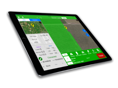
- Drives the Guidance System through any Apple device
- Wirelessly connect to the Lightbar and Hub
- View your spray screen with imagery background (Apple Maps)
Wireless
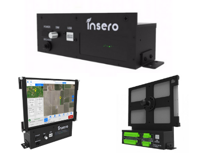
- Connect switches, meter and valve to the hub
- No bulky cables and oversized connectors
- All cables can be cut to length
GNSS Guidance
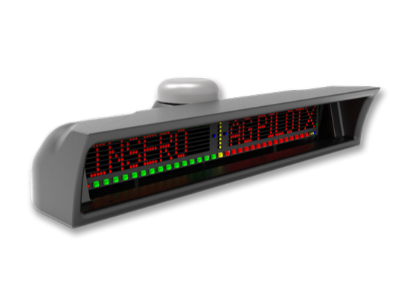
- Wireless Lightbar with GNSS (GPS + GLONASS) and Antenna built in
- Completely wireless communication
- Lightbar only needs power and ground
The AgPilotX Smart Lightbar provides guidance and has the GPS/GNSS onboard. It also includes the GPS/GNSS Antenna so there is no need to run an antenna up to the aircraft canopy. All data is initially stored in the Lightbar and can be moved in a number of ways (to a USB stick or wirelessly to an iPad/iPhone or even pushed directly to the cloud).
Insero’s GPS/GNSS receiver also uses GLONASS satellites, doubling the number of satellites wherever the aircraft is flying. This is especially helpful when satellite coverage is spotty at certain times of the day or in particular areas.

The AgPilotX System includes the latest cell-based Apple iPad Pro with the AgPilotX App pre-loaded. Any time a software update is available, it will prompt the user to update with one button push. Additionally, you can download the free AgPilotX App from the Apple App Store onto any Apple device.
The latest iPad Pro has a high bright screen that is visible in direct sunlight and Apple has focused on better heat dissipation to prevent iPad overheating. Additionally, the AgPilotX Lightbar is not dependent upon the iPad to operate and will continue to work the active Job even if you start using a different App or even shut the Apple device completely off.
If the Apple device is connected to the internet, AgPilotX will display Apple Maps (Imagery, Street Maps or Hybrid) as a background. If you are not connected, AgPilotX will simply draw the aircraft path and paint the swaths over a blank background. Shape files can be emailed or loaded to view in the AgPilotX App as well. Certain software packages like Chem Man can even push Shape files directly to AgPilotX.

The small Hub provides a location to connect switches and devices. Aircraft swath advance/decrease switch, spray on/off and even the Laser Altimeter wires connect here. The Smart Hub also serves as the Flow Controller. Connect the meter and valve to the Hub. No additional boxes necessary.
No more bulky cannon plugs. Connect all wiring directly to the back of the removable connectors in the Hub. No more drilling large holes in the aircraft to feed oversized connectors.
